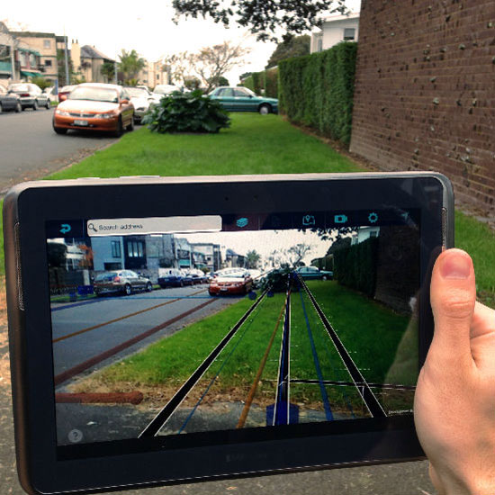
Augview is a radically new asset management app that combines interactive GIS map view with GPS driven augmented reality overlays. GEO AR (GPS driven augmented reality) is basically 3D objects, models or animations that live in a physical space based on GPS coordinates. No markers are needed. The virtual world merged with the real world is visible via an app and a digital device such as a smartphone or tablet or in the near future AR glasses. Augview allows the user to walk around and see the underground assets on the go, created on the fly from data that sits on a secure server at the main base.
- The client app communicates in a similar way to your online banking system.
- No data is copied onto your digital device, so that if you happen to lose your tablet or it gets stolen, no harm is done.
- We can even geo fence and restrict the area in which the device is being used.
- Augview was founded in August 2012 and our product is brand new.
- We are currently looking for savvy beta testers who have access to ESRI ArcGIS Server, Smallworld GSS or other OGC-compliant web servers with utility, telco or other data already published.
- Augview dynamically creates a 3D representation of your asset data based on your GPS location so that your field staff are safer, projects are being done faster, the team communication is improved and your company saves money.
- Best of all though, your team can use Augview for planning, redlining, supervising a project and updating existing data.
- In some of our videos you will see that the interactive map viewer as well as the AR view allow you to select an asset, check the data information and update it as required.

